Browse products
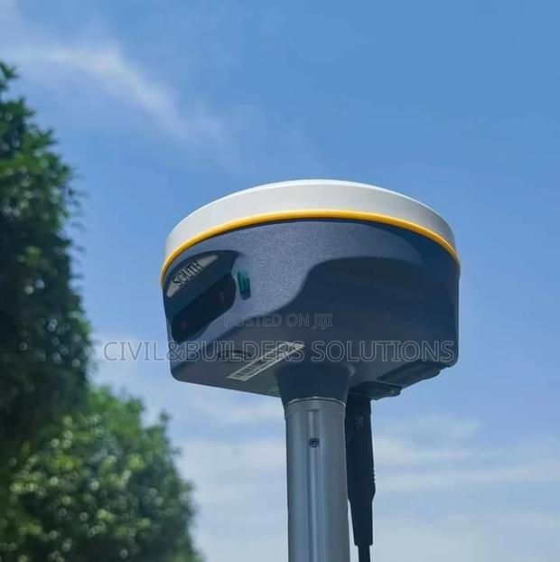
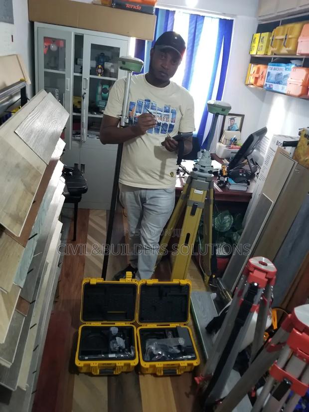
Rtk Gnss Receiver
RTK is a high-precision positioning system used to improve GPS accuracy in real time

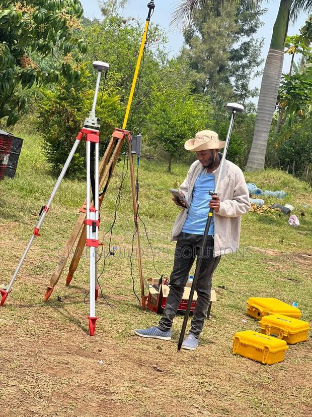
Rtk Rover Setup
RTK is a satellite-based positioning technology that provides centimeter-level accuracy in real time
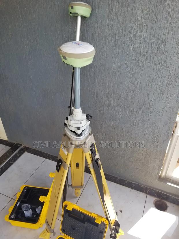
Gnss Base Station Rtk
RTK is an advanced GPS technology that delivers centimeter-level accuracy in real time
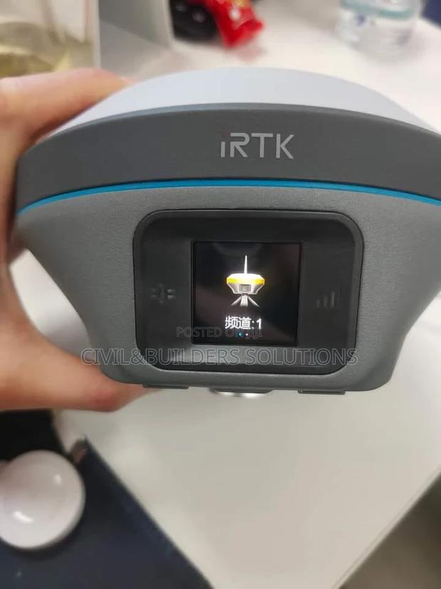
GNSS RTK(Global Navigation Satellite System RTK)
Real-Time Positioning: The system provides real-time corrections, allowing surveyors to obtain immediate, highly accurate positional data

Rtk Corrections
The Precise RTK is a high-accuracy GNSS receiver designed for professional surveying, mapping, and construction applications
Gnss Rtk System
GNSS RTK (Real-Time Kinematic) is a satellite-based positioning system that delivers fast, high-accuracy location data for surveying, construction, and mapping
Multiband Gnss Rtk
RTK is a GPS-based technology that delivers high-precision positioning, commonly used in surveying, construction, and agriculture
Precision Gnss Surveying Rtk
Precise RTK (Real-Time Kinematic) is an advanced GPS/GNSS positioning technology that delivers centimeter-level accuracy instantly by using correction data from a fixed base station
Precise Static GPS Surveying
RTK (Real-Time Kinematic) is a satellite navigation technique used to enhance the precision of GPS positioning
GPS RTK( Global Positioning System RTK)
High Accuracy: RTK provides centimeter-level accuracy by correcting GNSS (Global Navigation Satellite System) signals in real-time, essential for precise mapping and construction work
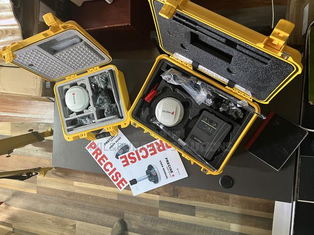
Rtk,Precise X
Precise RTK is a high-accuracy positioning system used in surveying, mapping, and construction to deliver real-time centimeter-level precision
Rtk Gps Rover
GNSS RTK – Real-Time, High-Accuracy Positioning GNSS RTK uses satellite signals combined with correction data from a base station to deliver fast, centimeter-level accuracy
RTCM Rtk( Radio Technical Commission for Maritime Service)
RTK is a high-precision satellite positioning method that uses correction data from a nearby base station to deliver real-time, centimeter-level accuracy

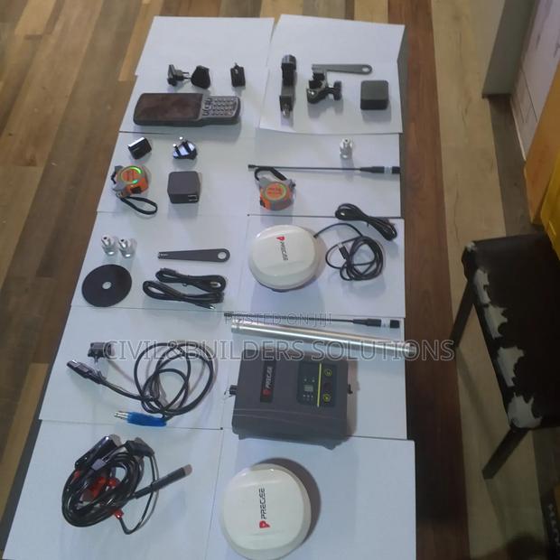
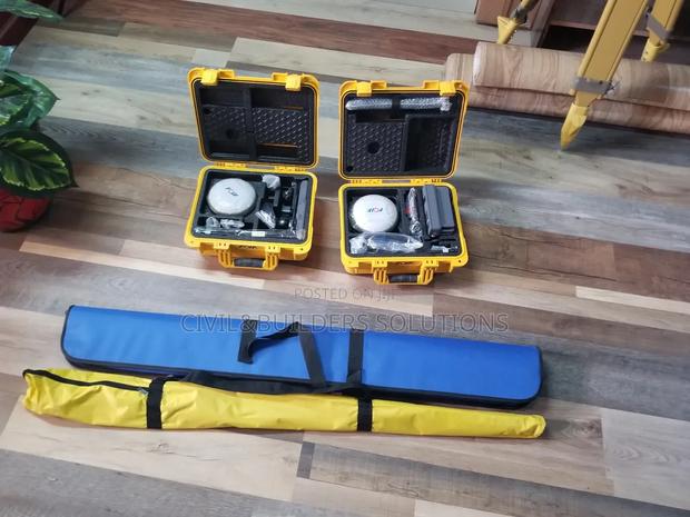
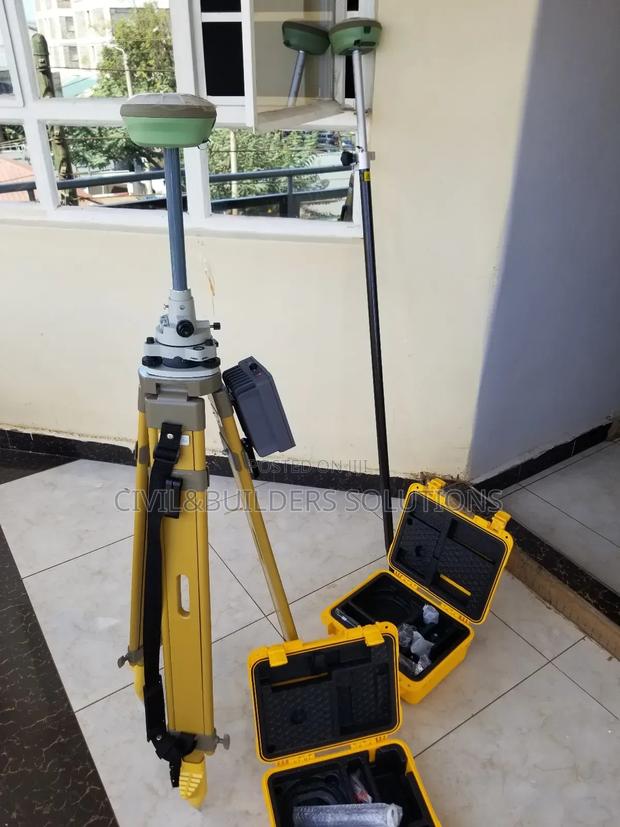
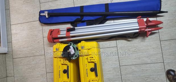
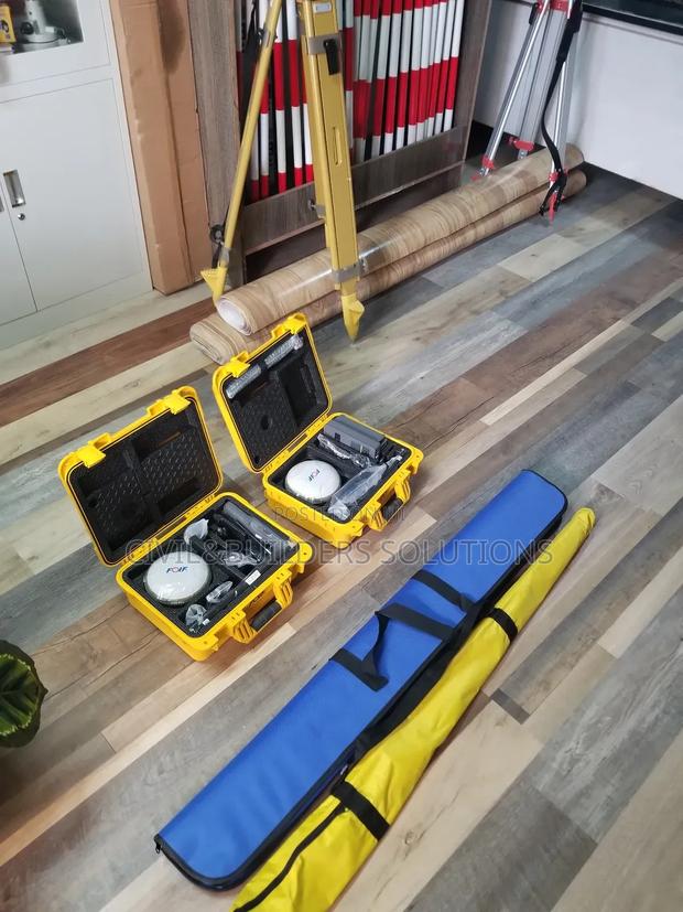
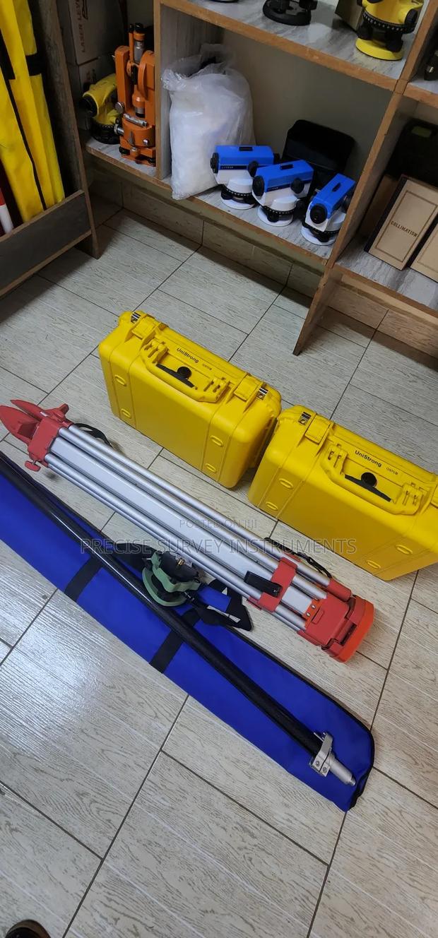
Full Set Precise Rtk Rover
The Precise Rover is a reliable, real-time kinematic (RTK) GNSS receiver designed for accurate land surveying, construction, and mapping
Network RTK GPS for Real Time Corrections
Gnss receivers that uses NTRIP oR CORS network for real time positioning without a physical base...
Precise X7 Rover RTK
The Precise X7 Rover RTK is a high-performance GNSS receiver designed for real-time kinematic (RTK) positioning
Rtk Foif Surveying
RTK is a high-precision GPS technology used in surveying, mapping, construction, and agriculture to provide real-time, centimeter-level accuracy
Different Gps Rtk
Base and Rover Configuration: RTK operates using a base station that provides correction data to one or more rover units
Precise X RTK System
The Precise X is a professional GNSS RTK receiver that provides real-time, centimeter-level positioning for surveying, construction, and mapping
Gnss Rover Rtk
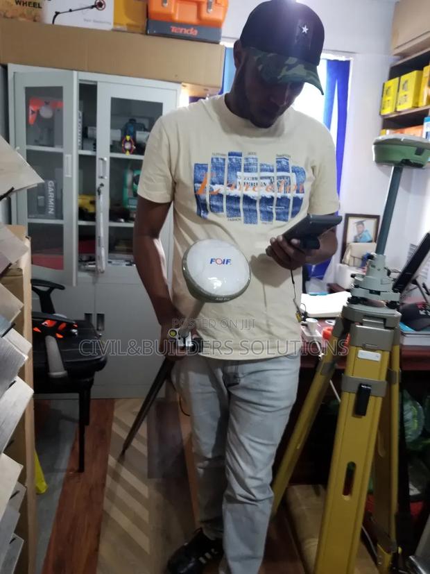
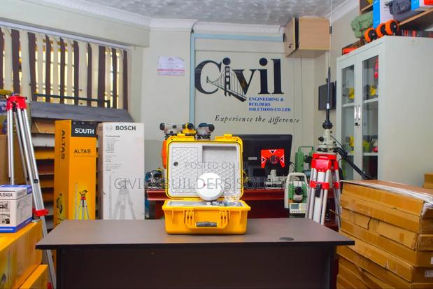
Survey tools are used to gather accurate information about land, structures, and boundaries
GNSS Receiver With Tilt Compensation
Rtk Gps units that allows precise measurements without needing the pole to be perfectly vertical.

The Precise X RTK GPS/GNSS Receiver
The Precise X RTK GPS/GNSS Receiver is a high-accuracy surveying instrument designed for professionals who demand speed, reliability, and precision
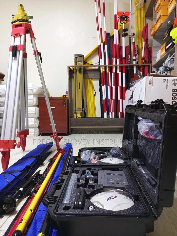
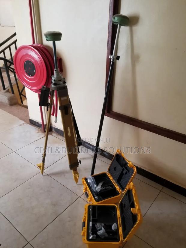
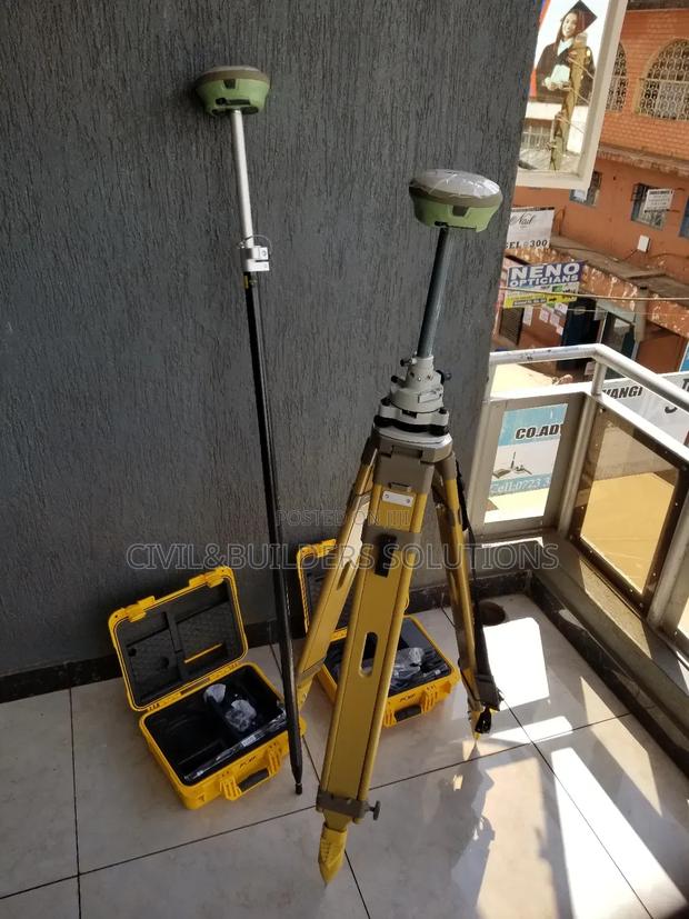
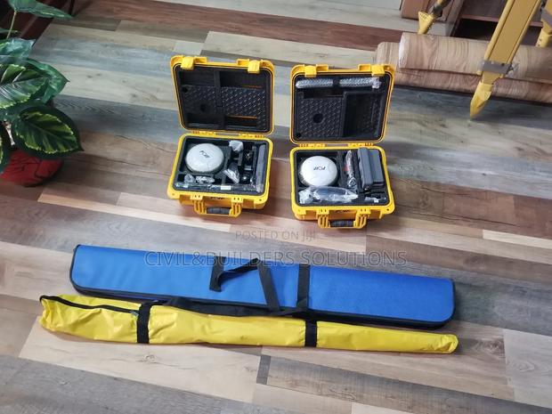
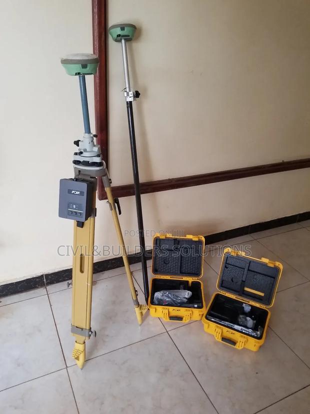
RTK/ GNSS Machine Set (Foif A90)
Real time kinematic positioning (Rtk) satellite navigation system complete set with all standard accessories

RTK GNSS ( Precise X Mode)
The Precise X is a survey‐grade RTK (Real‐Time Kinematic) GNSS receiver Key Features: • High‐precision RTK positioning: ~±8 mm + 1 ppm (horizontal) and ±15 mm + 1 ppm (vertical) accuracy with real‐time corrections