Multiband Gnss Rtk

SKU: EiV5279er2K8zFS2diYMmLIn Stock
KSh720,000.00
No reviews
View at source

Product Description

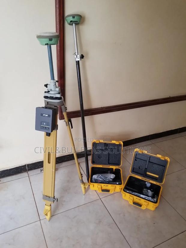
RTK is a GPS-based technology that delivers high-precision positioning, commonly used in surveying, construction, and agriculture. It provides real-time accuracy up to 1–2 cm, much higher than standard GPS. It works using two parts: A base station at a fixed, known point A rover that moves around the site The base sends correction signals to the rover, allowing it to adjust its GPS data instantly. Key Features Centimeter-level accuracy Supports GNSS satellites (GPS, GLONASS, etc.) Live corrections via UHF, Bluetooth, or SIM card Portable, reliable, and easy to use Used In: Land surveying Site layout Machine control Precision farming RTK boosts productivity and ensures accuracy in critical fieldwork.

Tags

Specifications

Condition
Not Specified
Availability
In Stock

Customer Reviews

Loading reviews...

Similar items

Rtk Rover Setup

RTK is a satellite-based positioning technology that provides centimeter-level accuracy in real time

Rtk Gnss Receiver

RTK is a high-precision positioning system used to improve GPS accuracy in real time

Gnss Real Time Correction Rtk

RTK is a satellite navigation technique that enhances the accuracy of GNSS (Global Navigation Satellite System) signals

Rtk Gps Rover

GNSS RTK – Real-Time, High-Accuracy Positioning GNSS RTK uses satellite signals combined with correction data from a base station to deliver fast, centimeter-level accuracy

Gnss Rtk System

GNSS RTK (Real-Time Kinematic) is a satellite-based positioning system that delivers fast, high-accuracy location data for surveying, construction, and mapping

Precision Gnss Surveying Rtk

Precise RTK (Real-Time Kinematic) is an advanced GPS/GNSS positioning technology that delivers centimeter-level accuracy instantly by using correction data from a fixed base station