Precise Static GPS Surveying
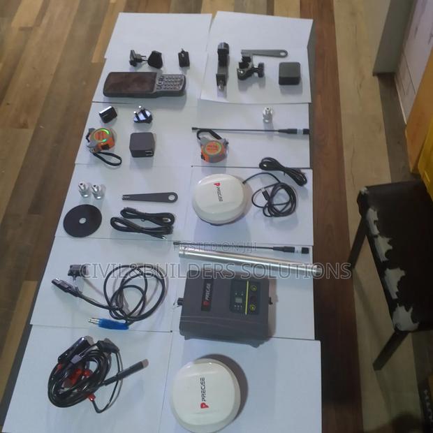
Product Description
RTK (Real-Time Kinematic) is a satellite navigation technique used to enhance the precision of GPS positioning. Precise RTK delivers centimeter-level accuracy in real time by using corrections from a base station to a rover receiver.
Key Features:
High Accuracy: Achieves positioning accuracy down to 1–2 centimeters
Real-Time Data: Provides immediate corrections via radio, cellular, or internet links
Reliable: Reduces errors caused by atmospheric conditions and satellite orbit variations
Versatile Applications: Used in land surveying, machine control, precision farming, and GIS data collection
Fast Setup: Quickly establishes accurate positions without post-processing
Compatibility: Works with most GNSS receivers that support RTK corrections
Improved Efficiency: Speeds up fieldwork and reduces errors compared to traditional GPS
Specifications
- Condition
- Not Specified
- Availability
- In Stock
Customer Reviews
Please log in to submit a review.
Log inLoading reviews...