Browse products

Topographic GPS Device
Versatility Multi-Use Capabilities: Garmin devices can be used for various tasks beyond surveying, such as hiking, outdoor navigation, geocaching, and field exploration

Waypoint Tracker
. Enhanced Navigation Route Planning: Garmin devices provide the ability to plot and follow routes, which is useful for surveys over large or rugged terrain. Navigation Features: Real-time guidance...
Geo Tracker Garmin
. Customizable Data Fields Users can configure the device's interface to display relevant survey data, such as coordinates, altitude, distance, or bearing, tailored to their needs.
Garmin Mapping Device
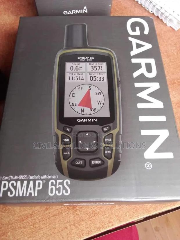
The Garmin GPS is a compact, durable navigation device designed to provide accurate location tracking and mapping, perfect for field surveys, hiking, and outdoor adventures

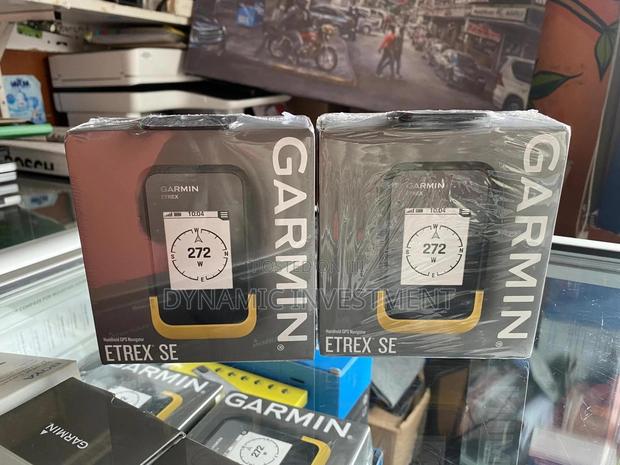
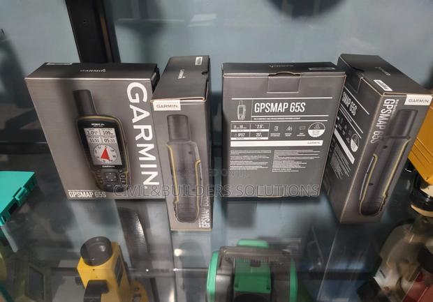
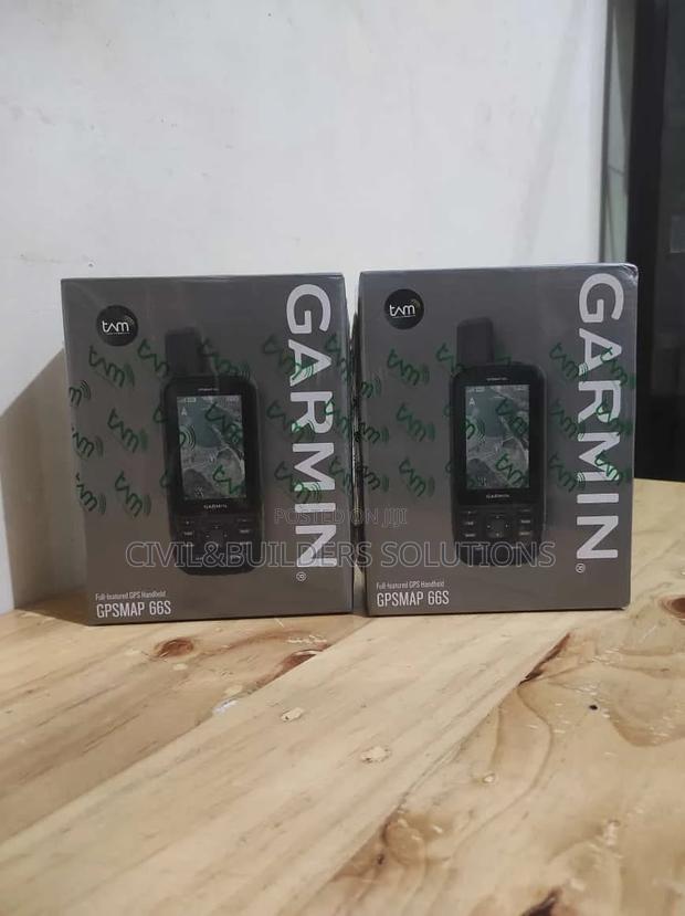
Garmin Gpsmap 65s Durable Field Navigation Tool
Heavy-duty GPS navigator ideal for construction sites, surveying, and exploration tasks

Mapping GPS Device
Data Collection and Management Real-Time Data: Surveyors can collect data on location, elevation, and other geospatial attributes in real-time
Mapping Tools
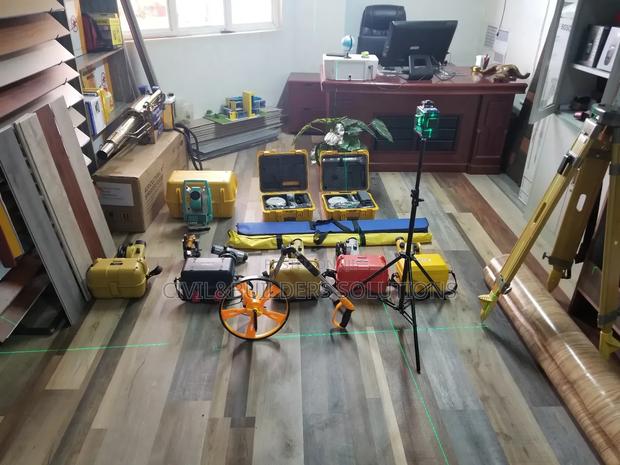
Survey instruments are specialized tools used to collect accurate measurements of land, structures, and terrain

Garmin Gpsmap 65s Survey Mapping GPS
Reliable GPS device suitable for surveyors, engineers, and construction field operations

Garmin Gpsmap 65s Navigation and Tracking Device
Reliable navigation tool with real-time tracking, waypoint marking, and route planning features

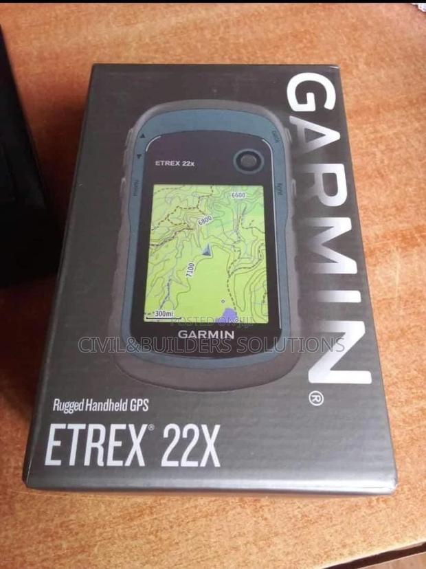
Garmin Etrex 22x Mapping Tool
Features of Garmin eTrex 22x: High-Precision GPS & GLONASS Support – Provides reliable location tracking, even in remote or challenging areas 2

Gps With Topo Maps Garmin
Garmin Rino GPS – Your All-in-One Outdoor Companion The Garmin Rino GPS combines advanced location tracking with built-in two-way radio communication, making it perfect for remote fieldwork, hikin...
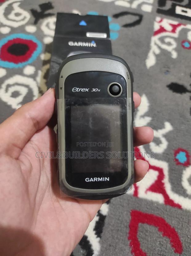
Handheld Gps Finder ( Garmin)
A handheld GPS is a portable device used to track location, navigate terrain, and record coordinates in real-time

Survey Materials
Versatility Multiple Measurement Modes: Many tools offer different modes like distance, angle, slope, and elevation measurement to handle various survey tasks

Global Mapper Pro 27 Gis Mapping Software Full Version
Get Global Mapper Pro full version for professional GIS mapping, spatial analysis, surveying, remote sensing, and geospatial data processing

Garmin Gpsmap 65s Heavy Duty GPS Navigator
Strong and dependable GPS device designed for demanding outdoor and surveying environments

GNSS Garmin Device
. Safety and Communication Emergency Features: Some Garmin models come with emergency beacons or SOS capabilities for added safety in remote survey locations. Two-Way Communication: The Garmin Rino...
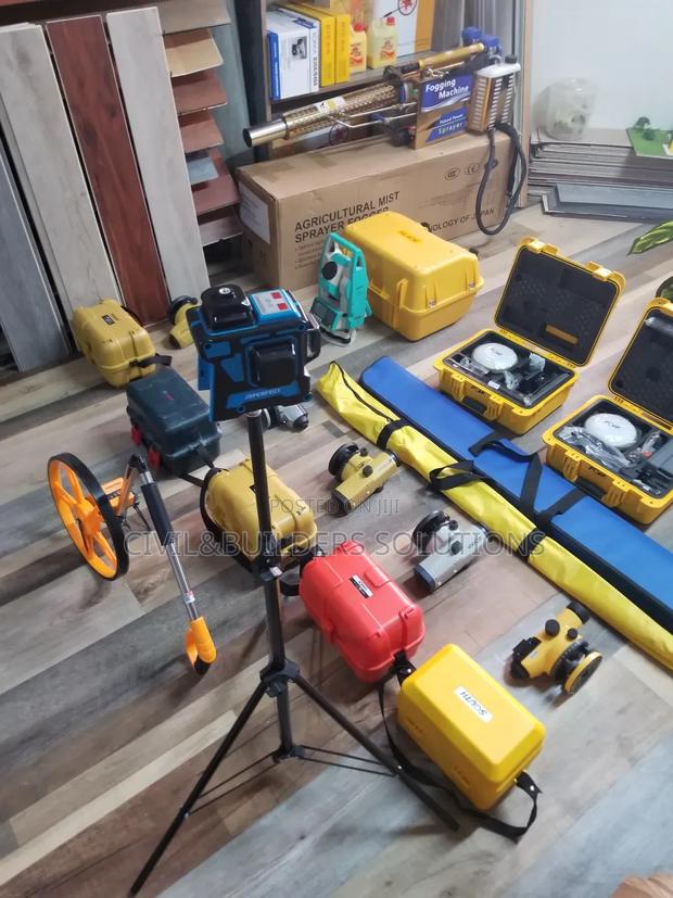
Topography Equipment
Survey instruments are precision tools used by land surveyors, engineers, and construction professionals to measure distances, angles, elevations, and coordinates accurately
Garmin ( Contour Data Collector)
. Barometric Altimeter Provides precise elevation data by measuring air pressure, making it ideal for contour mapping and terrain analysis.
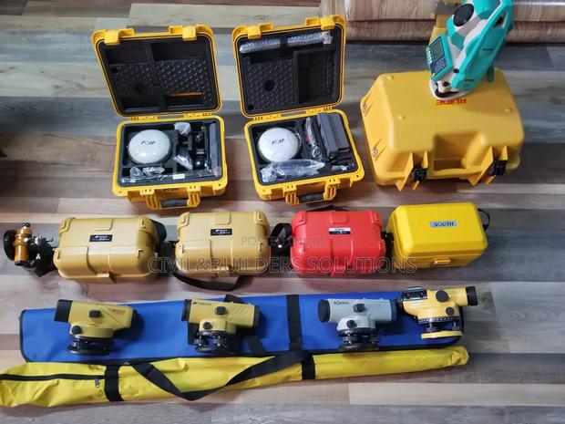
Survey Technology Tools
Survey tools are used to gather accurate information about land, structures, and boundaries
Garmin Gpsmap65 With Button
The Garmin Rino 750 and 755t are tough, all-in-one handheld devices that combine a GPS navigator with a 5-watt two-way radio

Garmin Gpsmap 65s Rugged Outdoor GPS Device
Durable and waterproof GPS unit designed for surveying, hiking, mapping, and fieldwork applications

Garmin Outdoor Gps Rinno 8
Garmin offers a wide range of reliable navigation and positioning devices designed for outdoor adventures, surveying, and professional fieldwork, providing accurate location tracking in any environ...
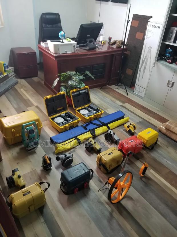
Measurements Survey Instrument
Survey tools are essential devices used to measure and map land features accurately